

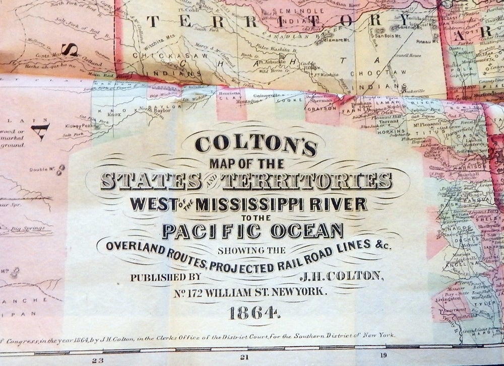
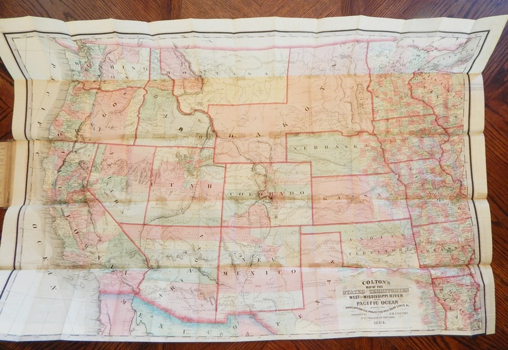
Colton's Map of the States and Territories West of the Mississippi River to the Pacific Ocean Showing the Overland Routes, Projected Rail Road Lines, &c.
New York: J. H. Colton, 1864. Hardcover. Very good. Item #21905 .
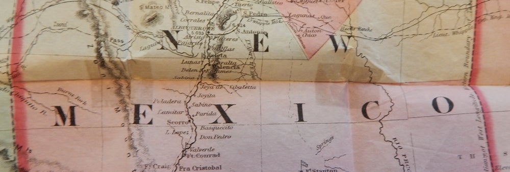
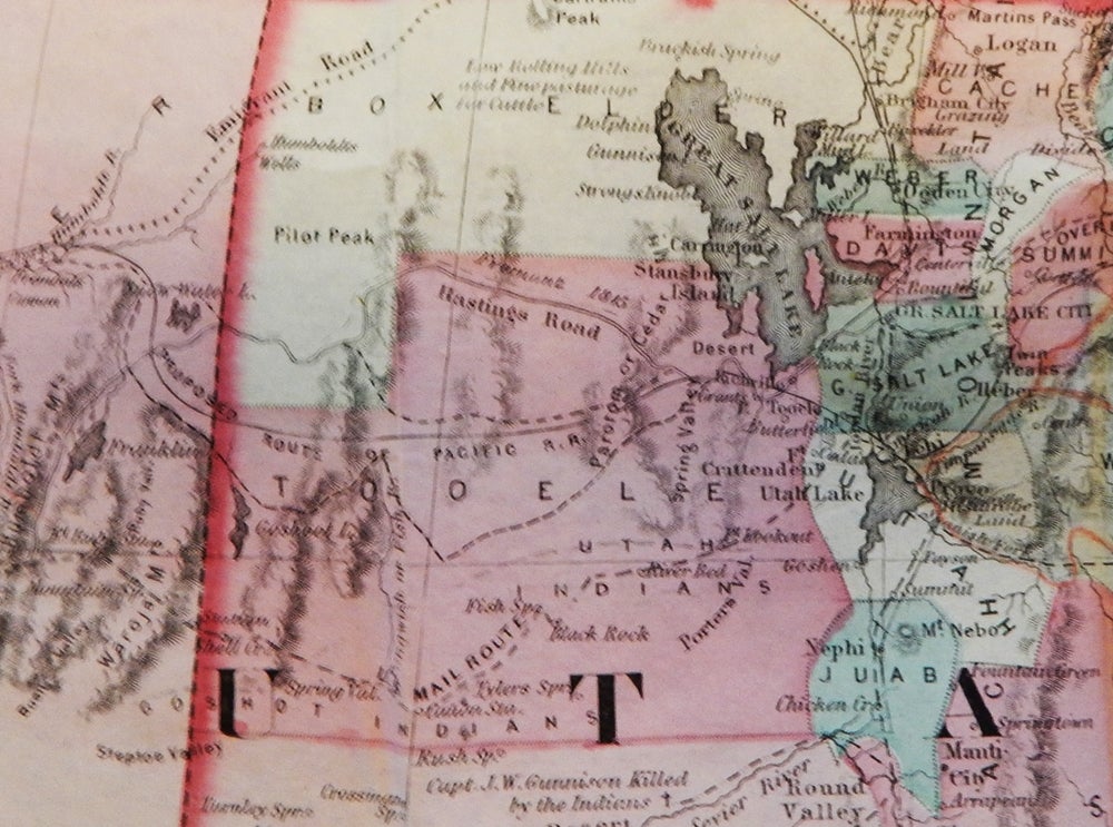
Lithographed map, hand-colored. Image size 29½ by 41½ inches, folded into a folder of brown textured cloth embossed in blind and gilt. The map has been reinforced on the reverse at the corners with what appears to be old archival glassine tape which does show as faint shadows on the obverse (see photo). It gives a very good appearance, with only light wear to the case at the edges and corners.
Streeter notes that this map predates the setting apart of Montana Territory, and the route of the Pacific RR is south of the Great Salt Lake. "It was an excellent map of the West as it was at the time of the Civil War." Streeter, 3072
Price: $10,000.00